
Shoreline Changes Can Make Property Boundaries Less Obvious, Which Is Where Land Surveying Helps
A boundary survey on most inland properties confirms something that rarely changes. The fence is still the fence. The tree line still sits roughly where it was twenty years ago. Waterfront property doesn’t offer that same stability. The shoreline itself moves, sometimes a little each year and sometimes all at once during a single storm. That movement can quietly separate what a property looks like from what its legal boundary actually says.
This creates a strange problem for waterfront owners. The landmarks people naturally rely on, a fence, a row of trees, a stretch of beach, can shift without anyone touching them. The boundary line on paper hasn’t moved at all. The land around it has.
Coastal Erosion and Storm Events Can Alter Familiar Property Landmarks
Wind and waves work on a shoreline constantly, even on calm days. Most of the time the change is too slow to notice. A few inches of sand disappear here. A little vegetation creeps in there. Over the course of a normal year, nothing looks dramatically different. Add a hurricane or a major storm surge, and years of gradual change can happen in a single afternoon.
This kind of erosion doesn’t just reshape the beach. It reshapes the landmarks property owners use to mentally track where their land begins and ends. A fence line that used to sit comfortably inland might end up close to the water’s edge after a few seasons of erosion. Vegetation that once marked a clear boundary between properties can wash away entirely, leaving nothing where a visual reference used to be.
The tricky part is that none of this changes the actual legal boundary. A property line described in a deed doesn’t move just because the shoreline in front of it does. What changes is how well the visible landscape still matches that legal description. After a few storms, a property owner standing on their land might be looking at a completely different picture than the one their grandparents used to navigate decades earlier.
Why Waterfront Property Owners Should Not Rely on Old Visual References
Seawalls, docks, and retaining structures feel permanent. They’re built from concrete, wood, and steel, and they look like they belong exactly where they sit. But waterfront infrastructure gets repaired, replaced, and rebuilt more often than people expect. Each version doesn’t always end up in the exact same spot as the one before it.
A seawall replaced after storm damage might be rebuilt a few feet from where the original stood. New construction often follows updated engineering rules rather than the old footprint. A dock rebuilt after years of wear might shift slightly to account for new water depths or a different boat. None of these changes get announced to the neighbors. They just happen, gradually, project by project, until the structure everyone used as an informal boundary marker sits somewhere slightly different than it once did.
Landscaping adds another layer of drift. A hedge planted along what someone assumed was the property line might have been planted a few feet off from the start. Years of growth and trimming can shift its apparent edge even further. None of these gradual changes are dramatic on their own, but they add up. A property owner who trusts these old visual references can end up making bad decisions. Checking the actual recorded boundary matters more than trusting a line that was never quite right to begin with.
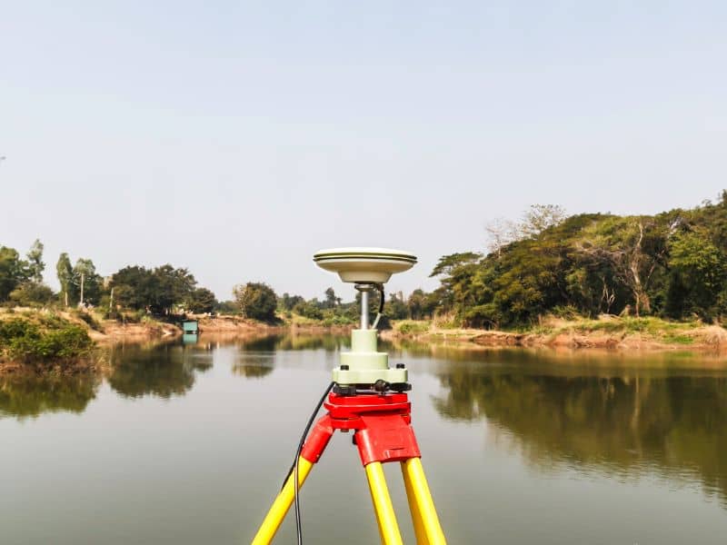
Land Surveying Provides Accurate Boundary Information Along Changing Shorelines
This is exactly the kind of uncertainty land surveying exists to resolve. A professional survey doesn’t rely on what a fence or seawall currently looks like. It works from the legal description recorded for the property. It cross references historical survey records when they exist. It takes precise field measurements that establish exactly where the boundary sits today, no matter what the surrounding landscape has done in the meantime.
Coastal properties often involve legal concepts that don’t come up on inland parcels at all. Some waterfront boundaries are tied to natural features, like the mean high water line, rather than a fixed point. A surveyor working a shoreline property knows how to apply these rules correctly. They translate a legal description that might reference natural, shifting features into an exact, measurable boundary on the ground as it exists right now.
This precision matters because visual estimates simply aren’t reliable on shoreline property the way they might be elsewhere. A measurement-based approach removes the guesswork. It replaces a boundary based on a fence that may have drifted, a dock that’s been rebuilt, or a tree line reshaped by years of wind and water.
Property Improvements Near the Water Benefit From Verified Boundary Locations
Anyone planning a dock, a walkway, a new seawall, a patio, or an addition near the water benefits from one thing above all. Knowing exactly where their property begins and ends before construction starts. Building too close to a boundary, or worse, partially across it, creates problems. These can range from awkward conversations with a neighbor to genuine legal disputes that cost far more than a survey would have.
A few specific situations make this verification especially valuable:
- A new dock or walkway planned near a boundary shared with a neighboring waterfront property
- A seawall or retaining structure that needs rebuilding in the correct location after storm damage
- An addition or patio planned close enough to the water that setback rules and boundary lines both come into play
Verified boundary information gives property owners and their contractors a clear, confirmed starting point before any of this work begins. Skipping that step and building based on assumption is one of the more common ways waterfront improvements end up needing costly rework.
Real Estate Transactions Are Easier When Coastal Boundaries Are Clearly Defined
Waterfront property transactions move more smoothly when boundary lines are clearly established rather than left as an open question. Buyers want confidence that the property they’re purchasing matches its legal description. Lenders want the same confidence before approving financing tied to that property as collateral. Attorneys handling the transaction need accurate boundary information to address any title questions that come up along the way.
Clear boundary information also helps prevent disputes that might otherwise surface after closing. A new owner starts making improvements, or discovers a neighbor disagrees about where the line actually falls. A survey completed before the transaction closes gives everyone involved the same accurate picture to work from. That includes the buyer, the seller, the lender, and the attorneys.
This matters more on coastal property than almost anywhere else, simply because the landscape itself is less stable. A clearly defined boundary, confirmed through proper land surveying rather than assumed from visible landmarks, gives everyone in the transaction confidence. What they’re buying, selling, or financing actually matches what the records say.
Frequently Asked Questions
Why can shoreline properties have less obvious boundary lines?
Erosion, storms, changing vegetation, and new improvements can make visual landmarks less reliable over time.
How does land surveying help with coastal properties?
Land surveying uses measurements and legal records to establish accurate boundary locations, even when the landscape has changed.
Can old fences or seawalls indicate the true property line?
Not necessarily. Visible improvements do not always coincide with legal boundary lines.
When should a waterfront property owner consider a survey?
A survey is beneficial before building improvements, buying or selling property, or addressing boundary questions.
Who benefits from land surveying on shoreline properties?
Homeowners, buyers, sellers, developers, attorneys, lenders, and commercial property owners all benefit from accurate boundary information.